Navigating the River Slaney Part III by Brian Coulter
Killurin Pier is a useful place at which to stop on your voyage up the River Slaney or indeed you can start from here as there is good road access, two slips and a deep water quay. There is also a nice picnic area with seating and there are two pubs which serve food fairly nearby (800m).
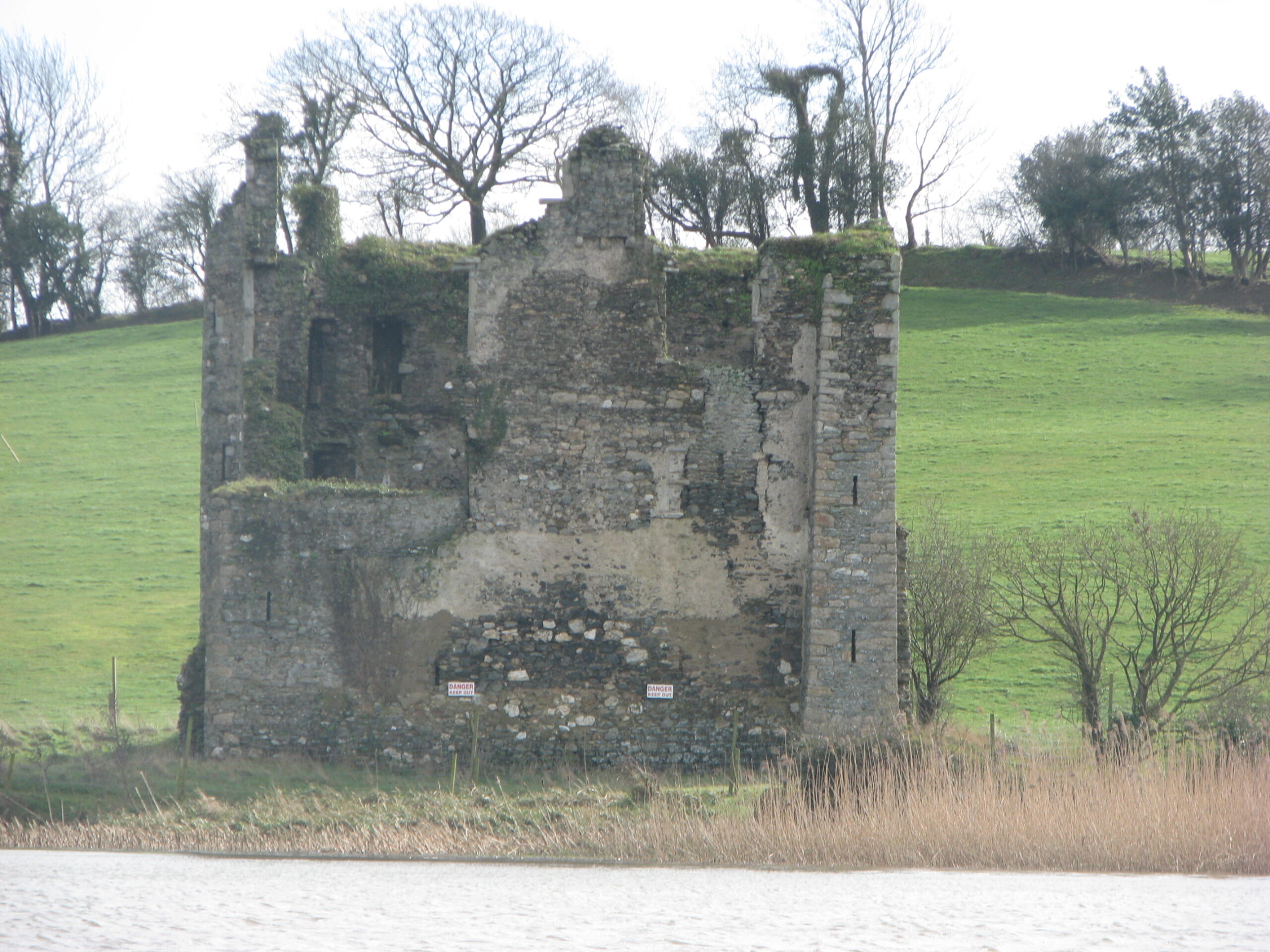 Upriver from Killurin, the deepest water is on the eastern side, it is up to 9m in some places . This area is known as The Deeps and as you round the next bend the medieval ruin of Deeps Castle is in a commanding position on the east bank. Originally the home of the Lord of Wexford, it passed to the Devereux family in the sixteenth century. After the Cromwellian campaign it was associated with the establishment of the Society of Friends (Quakers) in Co Wexford. In 1690, after defeat in the Battle of the Boyne, King James II stayed in (hid in?) the Deeps Castle on his way south to Duncannon.
Having rounded the bend at the deeps, stay in mid-river for about one nautical mile admiring the bevy of up to 50 swans that have made this place their home. During the severe gales this winter these swans discovered that they are much more comfortable sheltering in the grassy fields on the west bank and many of them have adopted this new habitat as their own. This is also the area of the river where otters are most commonly observed.
During this section you see the first of the new Patch Marks appear on the eastern side of the river. These are red and white striped spherical buoys which were placed there by the Branch to form an easy passage through the group of islands and sandbanks that is known as The Patches. Cecil Millar wrote “Navigation through The Patches currently requires local knowledge. Contact Slaney Branch, IWAI before entering this section”. By marking the track through it, the Branch has made this requirement unnecessary. However boaters should keep a sharp lookout for sunken timber. Trees and branches tend to get stuck in this section due to the twists and turns through the sandbanks. The Patches are overlooked at this point by the pretty little Bellvue church which was built as a private chapel built beside the Bellvue House, and is thought to have been designed by A.W. Pugin. The house itself was burned down in the “troubles” in 1923.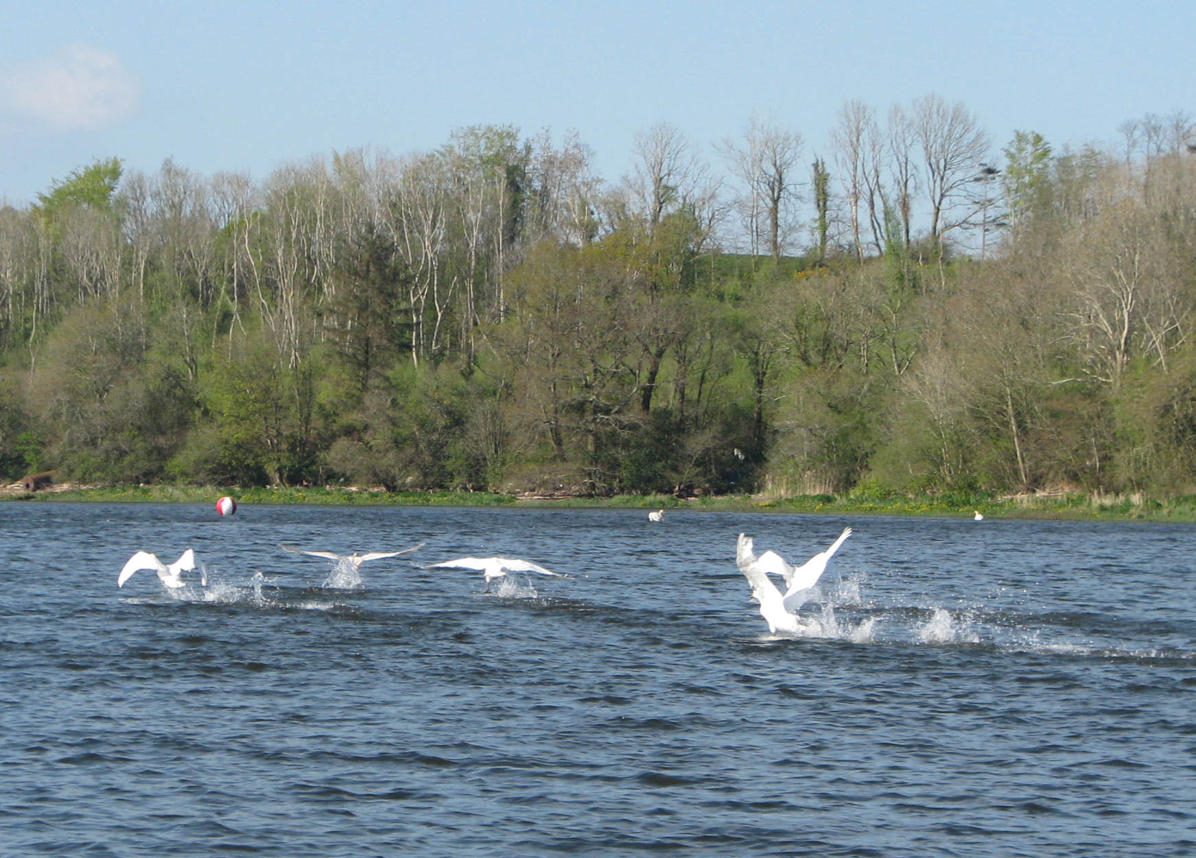
The five numbered Patch Marks can be passed on either side but keep close as the channel, though 2-3m deep at mid-tide, is quite narrow. When the last one is reached, stay on the eastern side for some 350m to the next waypoint, Carrig Wall, and proceed mid-river for another km to Kings Island. This island should be passed on the eastern side though canoes and unpowered craft may explore on either side. From here you can meander mid-stream for 2.5km when one gets to Edermine Bridge. This is the last of three bridges across the navigable section of the Slaney and it has a clearance of about 2.1m above highest astronomical tide. Just beyond the bridge there is a stopping place with slip on the west bank. Edermine House is situated on the east bank, it was the residence of the Power family who had the distilling business that made Powers Whiskey until the 1960s.
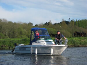
The Slaney has several slips suitable for launching and retrieval. The County Council is currently refurbishing the public slip at Ferrybank, Wexford. There is another slip near to Ely Hospital but the best facilities are at Wexford Harbour Boat & Tennis Club which has a slip, pontoon and crane as well as a pavilion with showers, bar etc. There is a private pontoon at the location of the former Oak Tavern in Ferrycarrig; the owner permits IWAI members to stop there, but one can go ashore only by arrangement with the owner or by arrangement with Slaney Branch, IWAI as the site is under development. At Killurin, there are two slips and a jetty with deep water, although care is needed, as the newer slip is very steep, and at least one car was lost without trace when the brakes slipped after a launch.
 About a km above Edermine the 13th century ruins of Brownswood Castle are seen on the east bank just before passing under some ESB wires. One km on, the river Boro flows into the Slaney on the west side. This is the third of the main tributaries; of these only the lower one, the Sow is navigable to small boats. Further on, the imposing red brick hospital on the east bank is St Senan’s Hospital and just past that one can see the River Urrin on the west bank with its imposing pedestrian bridge which is part of the delightful 2.5km River Walk. Only one km of navigable river remains before reaching Enniscorthy; unfortunately there is no useful quay or slip there though one can tie up or anchor to a grassy bank just at the Riverside Hotel.
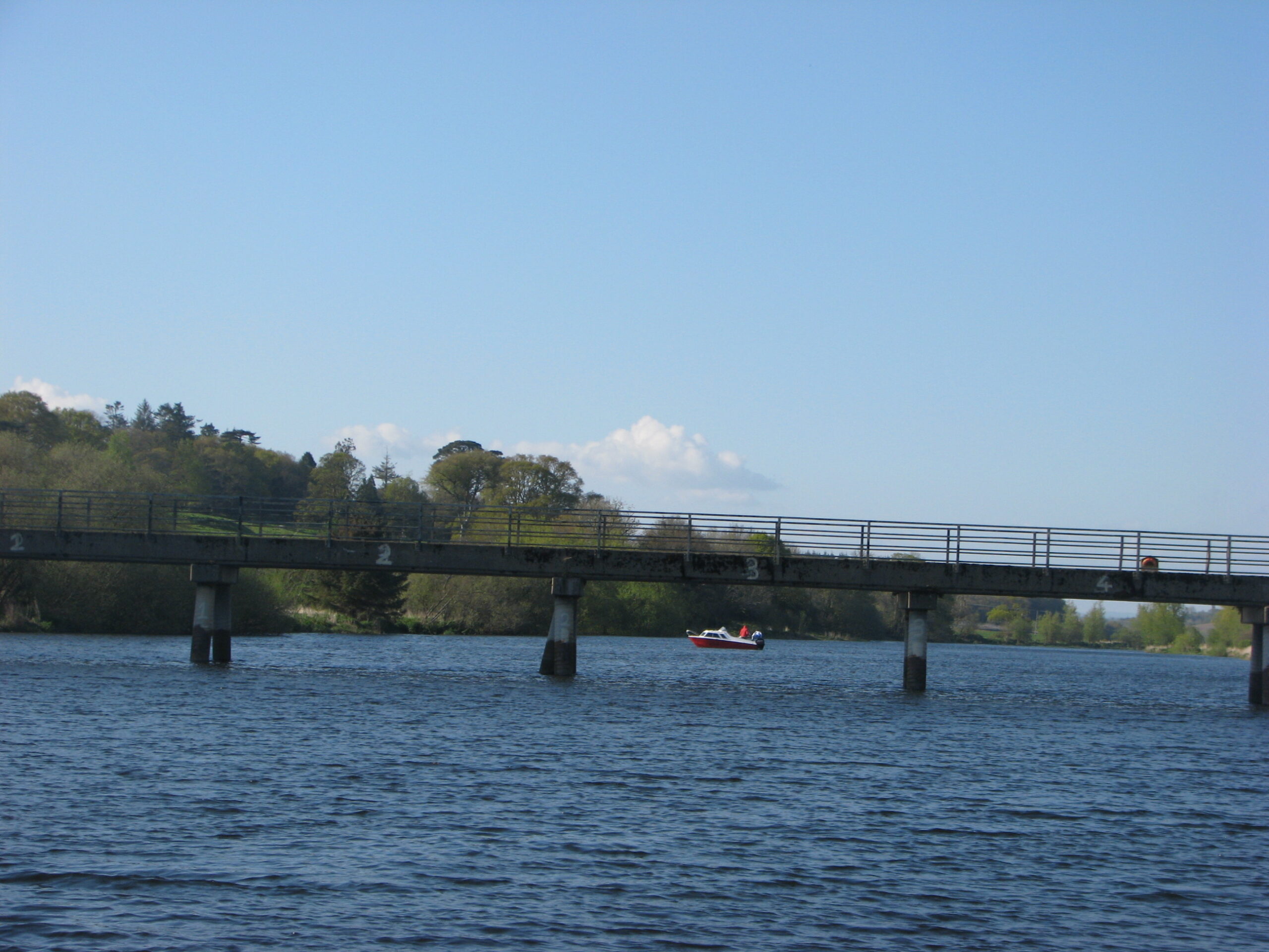
The Slaney is a beautiful river but for many years, boating was mainly concentrated into just two areas: close to Wexford Harbour and in the vicinity of Killurin Pier where the water is fairly deep. Now that the two difficult areas – Point of Park and The Patches – have been marked, it is hoped that many more locals and visitors will enjoy the full length of the tidal section up to Enniscorthy. The author wishes to thank the people who helped him re-survey the river and place marks, particularly John Tully for mark laying and Conall O’Brien for surveying. Sylvester O’Brien’s Slaney waypoints made the task very much easier. The Branch provided the marks and chain and Wexford Harbour Boat & Tennis Club donated the mooring blocks. The Harbourmaster is also thanked for permission to mark the Slaney as a continuation of the marking scheme for Wexford Harbour.
|
Id |
Name |
Latitude N |
Longitude W |
Depth at Mean Tide (m) |
| SLA 11 | Harry’s Quay |
52° 23.576′ |
6° 32.986′ |
4.5 |
| SLA 12 | Poldarrig |
52° 24.166′ |
6° 32.971′ |
3.1 |
|
Five safe-water (red/white striped) marks indicate passage through The Patches |
||||
| SLA 13 | Carrig Wall |
52° 25.142′
|
6° 33.346′ |
1.5 |
| SLA 14 | Fish House |
52° 25.387′
|
6° 33.855′ |
2.2 |
| SLA 15 | Kings Island E |
52° 25.818′
|
6° 33.770′ |
2.4 |
| SLA 16 | Scurlocks |
52° 26.326′
|
6° 33.718′ |
2.6 |
| SLA 17 | Coolteige |
52° 26.553′
|
6° 33.634′ |
3.2 |
| SLA 18 | Garrynisk |
52° 26.999′
|
6° 33.639′ |
3.8 |
| SLA 19 | Castle Haul |
52° 27.835′
|
6° 33.684′ |
2.2 |
| SLA 20 | Roadstone Quarry |
52° 28.277′
|
6° 33.763′
|
2.7
|
| SLA 21 | River Walk |
52° 29.541′
|
6° 34.181′
|
1.9
|