Navigating the River Slaney Part I by Brian Coulter
The tidal section of the River Slaney – from Wexford to Enniscorthy – has been navigable since the dawn of history. However only by shallow draft vessels; in 1836 it was written that “the Slaney River is navigable for any vessel that can come over the harbour bar to about six miles above Wexford. It is a natural river, and no means are used either to maintain or improve it”. The entire traffic was carried on Cots which were flat bottomed boats of 15 to 20 tonnes drawing about 1m. Depending on loading and tide these could usually go to about 3km of Enniscorthy, and sometimes the whole way. By the second half of the 20 th century commercial traffic on the Slaney had largely ceased leaving only fishing boats and leisure vessels.

Navigation on the Slaney has always been challenging, with many sandbanks and shallows to trap the unwary. Local knowledge was required but the need for this was greatly lessened by the publication of The Slaney Guide by Cecil Miller in 1988. The Slaney Branch of IWAI was formed the following year with the aim of improving boating facilities and introducing members to the beauty of the River Slaney. For over 20 years the Branch was very active and held boat rallies between Wexford and Enniscorthy. In recent years, changes in the River due to silting meant that local knowledge was again advised for boating above Killurin.
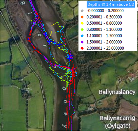
In 2011 it was decided that if the Branch was to survive, navigation aids would have to be provided to enable boats to make their way through The Patches, the shallowest section of the Slaney, about 1km above Killurin. This year a depth survey of the river from the Boat Club to Kings Island was done using a dory fitted with a GPS/sounder linked to a laptop computer. The dory was driven up and down the navigation channel and in between the sandbanks and ‘patches’ many times to get a digital picture of the channel depths. The sounder measured depth and position every second, this enabled time stamped depths to be measured at thousands of positions in the river. Because of the time stamp they could also be corrected for the state of the tide at the time. Using the GIS program ArcMap the data were converted to tracks coloured according to depth.
Figure 1 shows the GPS/depth tracks at Slaney Patches superimposed on the Bing aerial imagery of the same area. The accepted route through the Patches is indicated by the 6 blue crosses superimposed on the figure. It is quite clear that this is not the deepest channel; that much deeper water can be found by taking a western route rather than a central path between the sandbanks.
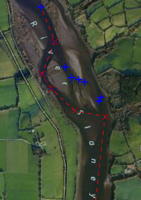
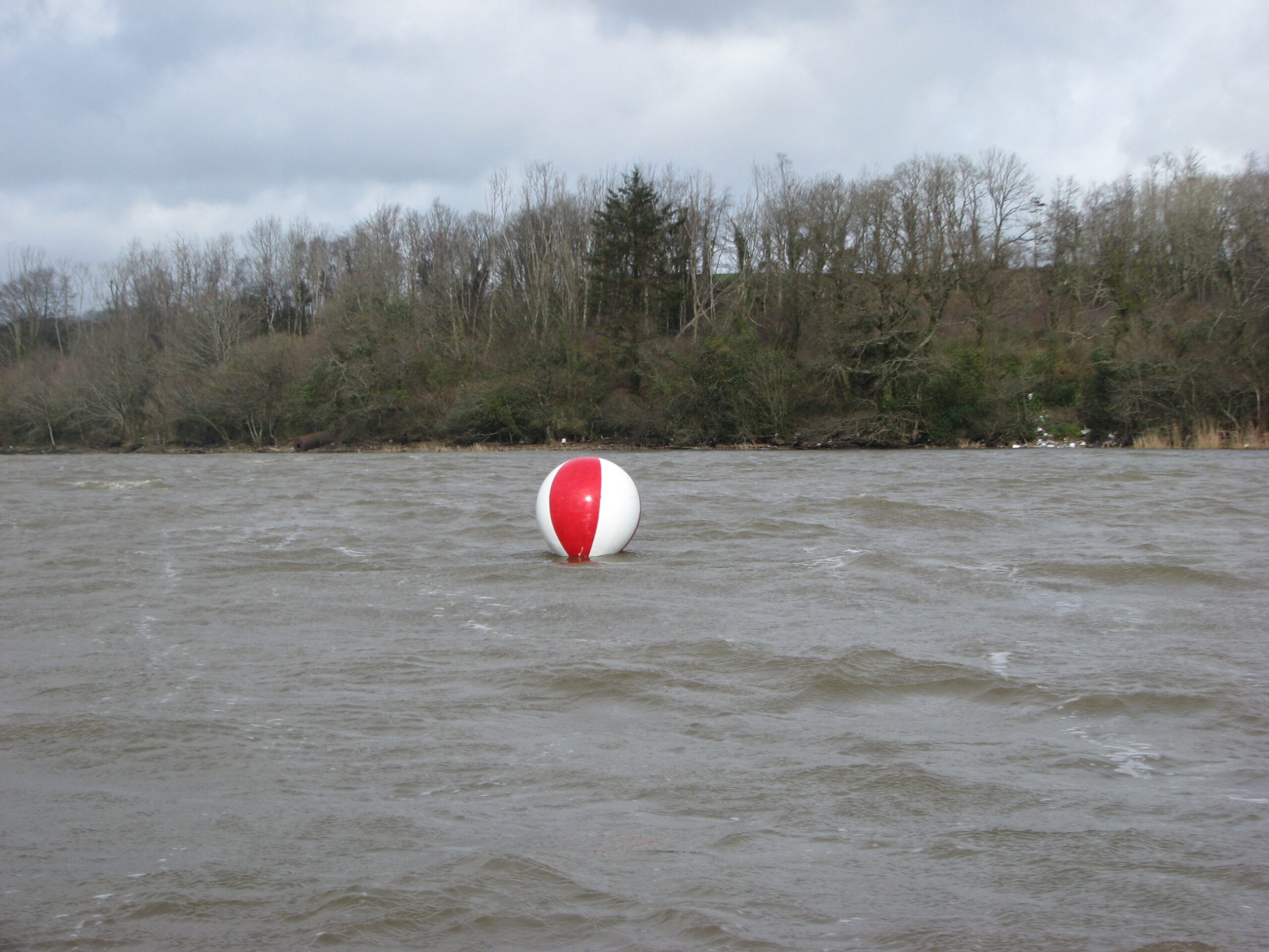
Figure 2 shows the Bing image with the proposed new route illustrated in red. The Slaney Branch has decided to buoy this route and has received the consent of the Harbourmaster. It is hoped that the official launch of the new route will coincide with the 2014 Slaney Rally. The first of 6 marks has now been laid (Fig 3) and the remainder will be laid over the months of March and April. Note that the mark colour is red and white banding.
This represents mid-channel marking according to the international buoyage convention. This marking was required by the Harbourmaster on the basis that the new marks should be compatible with the full marking system for Wexford Harbour which extends from the Bar Buoy (also a mid-channel mark) to the Ferrycarrig isolated danger mark off the Point of Park. The Harbourmaster’s remit extends as far as Enniscorthy and if there is a significant increase in traffic on the Slaney and an increased demand for buoyage, then the Harbour buoyage system may be extended as far as Enniscorthy and will incorporate the new buoys at The Patches.


