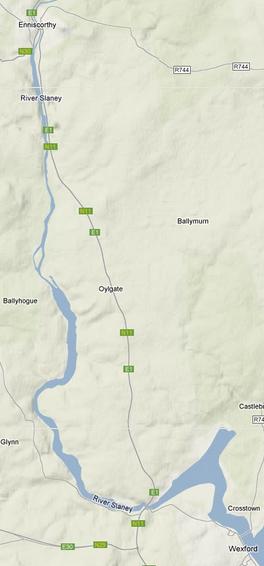
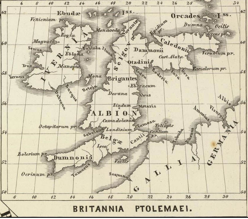
The river Slaney, flowing diagonally from northwest to southeast across Wexford and dividing it into two parts, has played a vital role in the history of the county. Mythology tells us that the river received its name from a chieftain named Slainghe and that the broad harbour into which it flows was called Loch Garman (the Irish name for Wexford) because a thief named Garman was drowned in its waters. The area around Loch Garman was called Menapia on Ptolemy’s second century map of Ireland and it is possible that there was a settlement of importance at the mouth of the Slaney at that time.
With the coming of Christianity a number of monastic centres were established on the Slaney. The most famous of these was Begerin, then an island in Loch Garman but now incorporated in the North Slob development.
Attracted no doubt by the broad harbour and the navigable river Slaney the Norsemen, or Vikings sailed into Lough Garman in 819 AD where they plundered the monastery on Begerin. This raid continued for almost one hundred years, but by the early tenth century the Norsemen had established a permanent settlement on the shores of Loch Garman, which they called Weisfiord – the bay of the mud flats. This settlement was to become the town of Wexford.
Almost three centuries later in 1169 the Norsemen lost the town to their Kinsmen, the Norman’s, who expanded the town and surrounded it with a stonewall. They also built the great castle of Wexford, (it was later pulled down – see history of the Ballybrenan canal) which was to be centre of administration of the county for almost five centuries.
There are two harbours at the mouth of the Slaney, an outer and an inner, connected by a ‘Narrows’ on which the town of Wexford is situated. For many centuries an important ferry operated across the river here and is remembered by the name Ferry bank on the north side of the Slaney. A wooden bridge, built by Lemuel Cox, an American, in 1795, replaced the ferry. He also constructed a bridge up river at Ferrycarrig at the same time. Cox’s bridge at Wexford was replaced in 1866 by a bridge further up-river beside the present boat-club and the present bridge, which was opened in 1958, in turn replaced this. The present structure is on the site of the ancient ferry and also Cox’s first wooden bridge.
As we commence our trip up river we pass through the narrows into the inner harbour (an online chart of the navigable section is available here). The slipway on the north shore was used by the Americans during the First World War when they had a seaplane base at Ferrybank. As the inner harbour broadens out the village of Castlebridge can be seen at the northern tip, where the river Sow joins the Slaney (See Map). The castle of Artramon is a prominent landmark on the west side of the inner harbor. This fifteenth century castle was originally a seat of the Roaches but was granted to the Le Hunte family in the seventeenth century. The nearby mansion of Saunderscourt also owes its origin to Cromwell’s grant of land to Colonel Robert Saunders in this area. As the boat rounds the Point of Park there is a good view of Park House and the scenic area of Ferrycarrig gorge appears straight ahead.
As we round the bend of the river at Ardcandrisk we see Cullentra House and Barntown House on the south bank. As the river swing around northwards we come to a small tributary on the west bank formerly known as the Pole or Pill, from which Polehore house gets its name. The house was a Furlong residence in medieval times but was given up for the manor of Horetown about 1309 and was subsequently known as Polehore. It was the residence of the great Wexford historians, Edmund and Philip Hore (See Map).
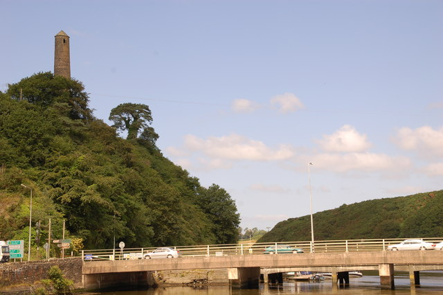
The skyline at Ferrycarrig is dominated by two buildings; the fifteenth century tower house built by the Roaches on the North side of the river to guard the ferry and the river passage, and the tall tower, modeled on the early Christian round tower, built in 1858 as a memorial to the men of Wexford who lost their lives in the Crimean War. This round tower stands in the middle of a very important archaeological site as it was here that the Norman’s built their first defensive site in 1169 known as Fit Stephen’s Castle of Carrick. Recent excavations have uncovered thirteenth century material.
Passing under Ferrycarrig Bridge, and past the picturesque Oak Tavern, the river begins to broaden out again above the gorge (See Map). On the south bank we get a fine view of the Irish National Heritage Park, opened to the public in 1987. This exciting project was developed by Wexford Council and Wexford Heritage Committee. Occupying a thirty-acre site beside the Wexford by pass it contains reconstruction of fourteen different historic sites, representing 9,000 years of Irish history. There is also an extensive nature trail, reception, interpretive center and restaurant. Ideally located, with panoramic views of the river Slaney, the park has unlimited potential in the fields of education and tourism.
Healthfield House, just up-river from Polehore on the west bank of the river, was built about 1820 by Edward Betty. The remains of Tykillen house can be seen opposite on the east bank.
The Furlongs also had a castle at Carrigmannon just north of Healthfield. The estate passed to the Devereuxs in the seventeenth century and was purchased by John Edward Redmond about 1850.
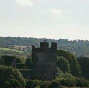
Passing under the Deeps bridge we pass Killurin on the west bank and the gaunt ruin of the Deeps castle can be seen on the east bank as we round a bend in the river. Strategically placed on the river Slaney this castle must have played an important role in the history of medieval Wexford and was retained in the hands of the Lord of Wexford (See Map). The builder is not known but in the sixteenth century it passed into the ownership of the Devereux family. After the Cromwellian campaign the manor of the Deeps passed to the Randall’s who were associated with the establishment of the Society of Friends (Quakers) in Co Wexford. The first Quaker meeting in the county was held at Edermine four miles north of the Deeps, in 1657. In 1690, after the Battle of the Boyne, King James II visited the Deeps Castle on his way south to Duncannon.
North of the Deeps two large houses come into view, Lonsdale House on the east shore and Bellevue on the west (See Map). Bellevue was built by George Ogle and after his death passed to Anthony Cliffe. In 1859 the Cliff’s had a private chapel built beside the house, thought to have been designed by A.W. Pugin. Bellevue House was burned in 1923.
Continuing northward we pass Jamestown House on the east bank and a large sawmill with a water wheel on the west bank. Passing King’s Island, Merton and Macmine can be glimpsed in the trees. Macmine Castle was built by the FitzHenrys but passed to the Richards family in the second half of the 17th century. A large mansion was added in the last century. It was used as a convent for a short time after the First World War.
Proceeding up-river we soon arrive at Edermine Bridge. Edermine House is situated on the east bank and a mysterious looking round tower on the west bank (See Map). Edermine House was the residence of the Power family who were associated with the distilling business (Powers Whiskey). They recruited most of their workers from nearby Oilgate where a terrace of houses built by the Powers for their workers, can still be seen today. The Powers also built a private chapel built at Edermine to the design of the famous architect A.W. Pugin.

About a mile above Edermine the river Boro flows into the Slaney on the west side. This river gives its name to Borodale House one of the residences of the Beatty family and home to Admiral Earl Beatty of First World War fame. About a mile further on we come to the remains of Brownswood Castle, also known as Black Castle on the east bank, built by the Browns in the 13th century (See Map). There are also the remains of a watermill near the Roadstone workings.
As the spires of Enniscorthy appear in the distance the imposing St Senans Hospital can be seen on the east bank. On the west bank the Urrin river joins the Slaney just above St Johns house, built on a medieval monastic site (See Map). The modern milling industry on the Urrin continues a centuries old tradition. The town of Enniscorthy with its two bridges grew up around the castle built by de Prendergast about the year 1240 on a rock over looking the Slaney. In 1595 Enniscorthy was granted to Sir Henry Wallop and the castle was subsequently restored by the Wallop family. It now houses the County Museum. The 1798 center just up from the river tells the story of the rebellion in Co Wexford and surrounding counties. Enniscorthy Cathedral was built in the 1840s by A.W.Pugin the greatest local example of his work.
This brief historical introduction should help to focus attention on the numerous interesting features to be observed while traveling along the Slaney. This was emphasized by Thomas Lacy in his book Sights and Scenes in Our Fatherland (1863) in which he observed, “By far the greatest treat that can be obtained in the vicinity of Wexford, and which no intelligent traveler who visits the town should lose an opportunity of enjoying, is the passage by water from Wexford to Enniscorthy.
Wild Life on The River Slaney
The Lower end of the Slaney Valley is a wonderland for wildlife but it has one serious drawback: it is difficult to get at. I’ve walked both banks in various stages but would not recommend it as an exercise. Access for cyclist and motorist is also difficult. The train affords a good view of the valley but the ideal way to see it is from the water. Whizzing along in a power boat is a sure way of seeing nothing: the best way to travel is to poke along gently and slowly in a small boat allowing yourself plenty of time to savor the rivers wildlife.
Ferrycarrig Bridge marks the rather dramatic transition from the broad lower reaches of the estuary to the narrower and more scenic upper part. During the last ice age the river ran south westwards to Wellington bridge and discharged into Bannow Bay. The spectacular Slaney Gorge at Ferrycarrig also dates from the Ice Age and since sea level was lower then than it is now the ancient river bed is below the present day sea level and is therefore flooded at high water causing the river to be influenced by the tide as far inland as the cathedral town of Enniscorthy.
The most striking waterside plant is Ireland’s tallest wild grass, the common read, which forms extensive skirting beds. Its tough stems are used for thatching and some fine examples of this ancient craft may be seen when passing the Irish National Heritage Park immediately up River of Ferrycarrig Bridge.
Where the valley sides are steep they are wooded and the great diversity of different habitats supports a wide range of wild flowers and interesting plants. The rarest plant ever found in the Slaney Valley was the short-leafed water-starwort. It was found once near Macmine Junction by E.S. Marshall in 1897 and was never found again either growing in the river Slaney or anywhere else in Ireland.
The earliest wildlife to be seen on the water is the bird life. A glimpse of a kingfisher flashing by is always a treat. Sand martins feed over the water at Park and Killowen. Cormorants are almost always seen diving for flatfish at Ferrycarrig Bridge. They roost upriver and their droppings kill the riverside trees that they live in; Grey herons nest in the top of the tall beaches opposite Ardcandrisk.
Bare mudflats at low water are favorite feeding places for redshank and blackheaded gulls and while these are the most common species it is not unusual to see gray herons, curlews, oystercatchers, shelducks, hooded crows and herring gulls as well as Mallard and tufted duck which are regularly seen together with mute swans in the quiet stretches of water.
Footprints in the mud evidence that otters are common but the biggest mammal that occurs is the gray seal. These pass up and down the river and sometimes haul out on the riverside rocks near the Castle at Killurin.
There is always something to interest the nature lover and to ensure that future generations may also enjoy this great natural resource it is important that those using the waterways should act responsibly towards nature at all times, should kill nothing but time and should take nothing but memories.
