Canal Feeders
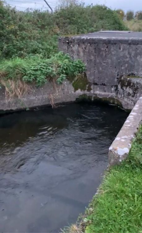
A Canal Feeder is a water supply with a control mechanism, that varies the volume entering the canal or closes it off completely. The source for these feeders can be a stream or river, with sluices or racks (sliding gates) as the method for controlling or diverting the flow.
The majority of these feeders were constructed as part of the original canal infrastructure and in many cases, are over 200 years old. The water source for many comes from a considerable distance. As with most of the infrastructure on the canals, they require ongoing maintenance. Some of these feeders have been closed off for various reasons; for example, poor water quality, lack of maintenance, omitted from restoration work or their source was diverted due to arterial drainage work.
Surface Water Drains
Water from these drains is uncontrolled, they totally rely on run-off from land adjacent to the canal, as their source. Many of these drains have been added to the canal system more as an outfall for land drainage, rather than as a water supply for the canal.
Problems can occur with these drains during excessively wet weather, as there is no method of diverting the water away from the canal. They do not appear to incorporate any facilities to allow for silt to settle, which results in the canal becoming the silt pond at the point of entry, which then affects the navigation.
Survey
The Nav-Watch Group is currently assessing the sources of water to the canals. The first step is a desk-based assessment of both the historic and present-day inflows into the Barrow Line, Grand, Naas/Corbally and Royal canals. The historic information has been obtained from the Ordinance Maps (1888-1913), Killaly’s Map from 1805 and the Architectural, Engineering and Industrial Heritage Assessment Reports carried out by Headland Archaeology for Waterways Ireland in 2007.
Work in Progress
Work continues on this project with the information being updated with present day data obtained from on-site visits by members of our Nav-Watch Group and from satellite imagery.
The accuracy of this desk-based information will be investigated, verified and revised as the project moves into the next phase. We hope to involve more IWAI members as they traverse our waterways and take part in walks organised by the IWAI.
To Date
The preliminary information we have to hand at present, would indicate that the upkeep and maintenance of some of the main water supplies is far from adequate, and several of these supplies have been cut off. However, more fieldwork is required to obtain all the required information.
© T Meehan Sep 2021


